


SF -> Point Reyes -> SF
- duration: 3 days
- length: ~ 95 miles
- elevation +/- 4000ft
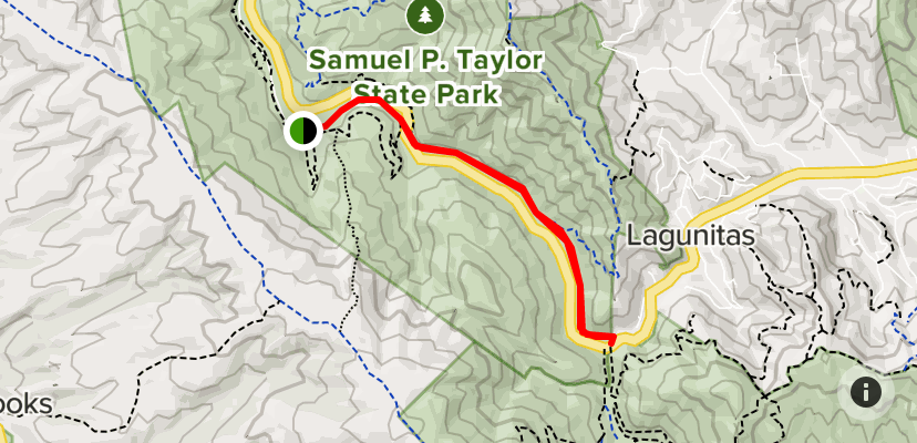
day 1: SF -> Samuel P. Taylor
this day we focus on simply getting towards the coast. the road is almost 100% paved the entire way, which makes this a overall pretty easy and casual day. at roughly 30 miles, we will have ample time to stop and get coffee, lunch, or beers as needed.
the goal is to get to campground at Samuel P. Taylor campground. they have a hike and bike section, if you don’t want to make reservations. it’s a relatively small campground nestled into the side of the hill next to a creek. there are some walking paths near by we could check out too. it’s really pretty, lush, and wet, but cold. you can tell right away when you’re biking into and out of the area, so make sure to bring warm clothes, as the park is roughly 10 degrees colder (farenheit) usually than san rafael.
most of this route is on the road. there is a section of double track towards the end that brings you right into the campsite - its called the cross marin trail. it’s super beautiful and totally worth taking, even though it’s relatively short.
day 2: Samuel P. Taylor <-> Marshall
this is our play day! we can bike to point reyes station, pick up some supplies if needed and get coffee, and make our way up towards marshall. the plan is to pick up oysters and have a picnic near millerton point. another option is to hangout at the bear valley picnic area just south of point reyes station, near olema. after that, we can head back to the campground before it gets dark. on this day, if you want, you can also take a bit of the cross marin trail which connects to the campground.
day 3: Samuel P. Taylor -> SF
this is just the reverse of the first map, so i won’t bother adding it here. Depending how tired we are, we could even take the ferry back from Larkspur or Sausalito into San Francisco.
referenced by:  bikepacking